Training Hike: Deschutes River

Katie and I did another PCT training hike last week. This time we took our backpacks and gear for an overnight and "gear shakedown" to see if everything was performing like it was supposed to. Since Portland's perfect March weather disappeared and it has been cold and rainy lately (seriously... what happened to those 70 degree sunny days we had a few weeks ago?!) we decided to head out of the valley and into the high desert.

Ironically, we decided on a backpack that Tanner and I did almost exactly a year ago, to the Deschutes River. I like it because it's long, flat, and sunny, best hiked in the early season before it gets too hot. It's also a great place to pound out some serious mileage, which was our goal this trip.

We headed out early, witnessing the amazing night-and-day transformation between the rainy, dark Columbia Gorge and the clear, sunny skies of the high desert. The abrupt change as you drive past the mountain range makes me think of those old cartoons where Wiley Coyote is running away from that single rain cloud. You could practically see the line in the ground where the weather changes.

We hiked fifteen miles in, going at a good pace of 3 miles/hour. My base pack weight came in around 15 pounds (minus food and water) but since I have to get used to packing in lots of water in the desert, I brought about 6 liters and that upped my pack weight closer to 30 pounds. Still, I was in good spirits, trying out a new lighter weight pack and new trail running shoes. Apparently the thru-hike trend the past few years has shifted from the traditional ankle-height backpacking boots to a lighter, meshier trail running shoe. The most popular on the PCT is the Brooks Cascadia.

At mile ten my feet were getting weary, and by mile fifteen it was a welcome rest to find a camp spot beside the river and set up the tent. My feet were doing okay, but the tops of my toenails felt tender and bruised, like they had been slamming into the tops of my shoes all day. It was my first time hiking in something other than boots, so it was an interesting change of pace to be carrying so much weight on a lighter shoe.

We cooked dinner and had a pack of MnMs each for dessert (the packages claimed they were "sharable size" bags, but we downed the whole thing - the best part of long-mileage hiking is the ability to eat a 400 calorie bag of chocolate without blinking an eye, right?) then settled down for the night.

The next morning we hiked back out the fifteen miles. My toenails were feeling better, but by the end of the hike my feet themselves were feeling bruised and battered on the bottoms. The last few miles got pretty painful and my pace slowed down a good bit. By the time we got home again, I was hobbling around the house and trying to soak my sore muscles. Two days in my compression socks made me feel much better, but I may have to review my gear choices again before setting out on another long-distance hike.

Either way, it was a beautiful day for a hike and I'm getting excited about our upcoming adventure.

PCT Planning Resources

There may come a time when you, too, want to hike the PCT. Or perhaps you have stumbled on my blog looking for more info on a hike you're already planning. I can attest, trying to plan for a five-month trek in the wilderness is no easy feat. But it can be accomplished with both exhaustive research and relatively little. As veterans of the trail will say: hike your own hike. Obviously some research/planning is preferable to none, but it's up to you to determine how much you want to know prior to the trip, and how much you want to figure out as you go.

I'm fortunate to own most of the gear I need (although I made some necessary purchases for lighter weight gear in some areas) so most of my prep revolves around planning and pre-conditioning. Since this is somewhat of a "last minute" trip, I've done most of this in a month's time. It's stressful, but it can be done. (I hope!) Here are the sites and resources I found most helpful. Hopefully they will help you, too, should you choose to hike the PCT someday.

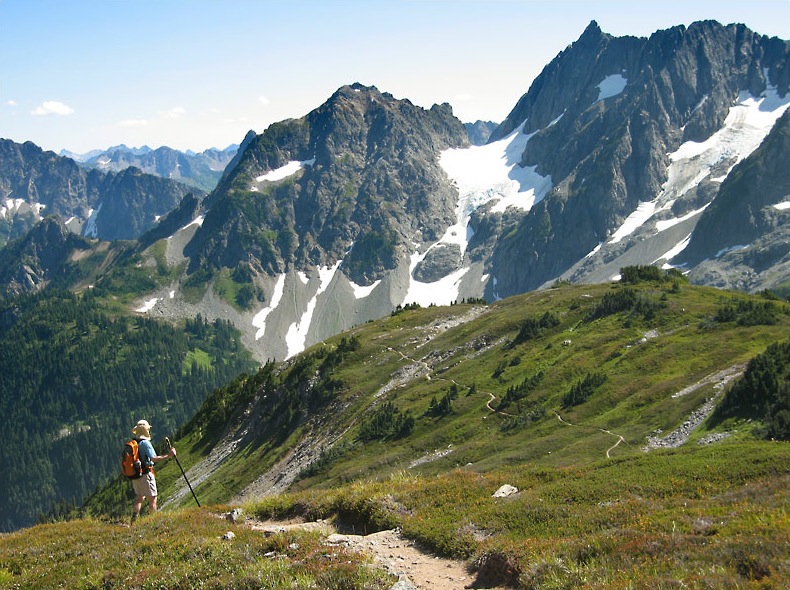
{North Cascades National Park: source}


PLANNING YOUR HIKE:

A simple step by step guide - this is a good place to start. Break your planning down into manageable chunks, plan backwards from your start date, and go from there.

Plan Your Hike - this site is exhaustively researched and very helpful when planning your hike. In particular, I found the

Resupply Page - to be very useful for my food drops/ town stays/ resupply strategy. Hiking the PCT takes a lot of forethought, and this website makes it much simpler. You could listen to me talk about PCT nonsense all day, or you could just visit this site and be done with it.

PCTA - the official website of the PCT. There are some great links on here that will tell you everything you need to know about the PCT, including trail closures, maps, regional info, and just some interesting history on the trail itself. Fun to browse even if you're not hiking!

Craig's PCT planner - this site does a great job of taking your stats: hiking speed, distance traveled, length of hike, and calculating dates of arrival at each resupply point along the trail. A good place to start if you're trying to figure out your timeline.

Postholer - A great guide for most of the long-distance hikes in the US.

Snow pack levels - 2011 was a record high for snowfall in the Sierras, and 2012 was a record low. Each year the snow levels can determine what kind of hike you will have. This site gives a great visual representation of how the snow levels are doing each month between Jan and May. (Compare and contrast May 2011 with May 2012... it's crazy!)

Permits - Whether you're long distance hiking or just doing a weekend excursion, you'll need wilderness permits for most of the PCT. Most of them are free or fairly inexpensive, so apply for them here ahead of time.

{Vasquez Rocks:source}


BOOKS/MAPS YOU'LL WANT TO OWN:

Yogi's PCT Guide - Yogi is a "triple crowner" - someone who has hiked the AT, the PCT, and the CDT (Continental Divide Trail) and she has put together a very thorough planning and guide book for the PCT. She interviews other thru-hikers, gives important info about towns and resupplies, not to mention gear choices, general planning guides and a complete look at the trail. If you only buy one book, this should be it.

Halfmile Maps - These maps (I hear) are by far the best. They are updated each year by Halfmile, who hikes the trail with his GPS and makes notes as he goes along to make sure the topo info and waypoints are accurate. And best of all? They are free! The only downside is that there are 450+ pages of them for the whole trail, so you'll probably end up shelling out some moolah to get them printed. Or you can download the PDFs to your phone and use them digitally that way.

PCT Data Book - A slim tome listing just the important stuff: water, resupply stats, town info, elevation, etc. Concise and factual. Small enough to carry in your pack or tear it up and mail yourself the pages.

Wild by Cheryl Strayed - Most trail memoirs I read are joyful, uplifting tales of a hiker "finding themselves" in one way or another on the trail. Wild is about finding oneself, but it's definitely more mellow in tone than many other similar novels. Cheryl Strayed has had a difficult life, but she explains it so beautifully in this book about hiking the PCT. If you're not crying half-way through the first chapter, there's something wrong with you.

* If you are interested in learning more about PCT iPhone apps to stay connected on the trail, check out this post, which goes into more detail

{Glacier Peak Wilderness: source}


TRAIL JOURNALS YOU'LL WANT TO READ:

Walking with Wired - Here is a great trail journal from "Wired", who thru-hiked in 2011. She has some great resources and a fun blog that she kept up while on trail.

Bacon Bit's PCT journal - This is a girl after my own heart. Way too organized for her own good, with some great documents about resupply stops and food planning. Her hiking blog is also great fun to read - she has a very poetic way of expressing herself. You'll enjoy it.

Heather and Sierra's PCT blog - The story of the youngest girl - at age 9 - to complete the PCT with her mom. What more do you need to know? I wish I had been that badass at nine!

Trailjournals - this site is a great way to read other blogs from thru-hikers of the PCT, the AT, and other long-distance hikes. I have found some very good authors on here.

Training Hike: Eagle Creek to Tunnel Falls

Since my long hike is now less than a month away (eep!) I've been trying to do some workouts that will help me prepare for the kick-off. Hiking 20 miles a day, all day every day, takes a toll on the body, so I'm attempting to prepare myself for that with some daily workouts. I've never been much of a runner (hiking = walking) but I've been trying to run every day to test out my joints (and my new shoes.) So far it's going well, though I get the usual sore-tired-muscles if I push myself too far. Thank goodness for compression socks. If you don't own a pair, you need to run out right now and buy some. I call them my magical socks. They make sore calves feel brand new. Seriously.

In addition to my lame-sauce little workouts (running is haaaaard) Katie and I have been trying to do some training hikes, to get used to longer days and longer mileage. Last week we hiked 14 miles along the Eagle Creek trail, which is actually an "unofficial" side-trail to the PCT, so it was rather fitting that we test it out. We just took just daypacks this time, and though the hike was pretty flat and easy, there were enough rocky, narrow ledges to keep things interesting. Plus, Eagle Creek is one of those trails where even if it's not raining, you're going to get drenched by the end of it. You're literally walking through high-cliffed waterfalls the whole way. Absolutely gorgeous. But not for the faint of heart - I tend to get a little vertigo if I'm not careful. And there's enough rock-hopping to keep your muscles entertained.

Though I have done this particular hike several times (see here and here) I have never been past Punchbowl Falls, which is only a 6-mile round trip. This time we went all the way to Tunnel Falls and a little beyond that before turning around and hiking out. Tunnel Falls (as it sounds) is a waterfall with a mossy, green tunnel hollowed out behind it. The whole hike is simply stunning, and no matter how many times I hike it, I fall in love with Oregon all over again.

My only regret is that I forced myself to bring my Canon point-and-shoot camera this time, rather than my Nikon DSLR. My Canon takes decent pictures, but it suffers with clarity on overcast hiking days or low-light/ highlight shots, so these pictures didn't quite live up to my expectations. But I'll have to get accustomed to it, because there's no way I'm lugging a 10 pound camera 2,650 miles in the back country. That would be foolish.

....Right? Right?? Anyone?

Bueller?

I'd be lying if I said I wasn't considering it.

After a pleasant trek through the woods, we celebrated our accomplishment with some Vietnamese food and then I spent the evening wearing my magical socks. Ahhhhh.

A Little Background on the PCT

Ok, back to PCT news. After my declaration Monday, I'm sure those of you unfamiliar with the Pacific Crest Trail want to know more. For those of you who have never heard of the PCT (although Cheryl Strayed's latest book Wild highlights the trail much like Bill Bryson's A Walk in the Woods highlighted the Appalachian Trail, so it may be more main-stream knowledge, now) it is a 2,650 mile trail that runs from the border of Mexico to Canada, passing through California, Oregon, and Washington along the way. Many hikers attempt to finish the entire route in one summer season, effectively calling themselves "thru-hikers" and manage to hike it within five months or so. (Generally May to September, since that's when snow levels are least likely to affect the trip.)

Obviously the choice to thru-hike a trail like the PCT or the AT is quite an undertaking, and not only does it require some courage, dedication, and a serious amount of free-time, but it tends to be an activity which can be rather life-changing for those who undertake it. Often the thru-hikers are those wide-eyed early 20-somethings with their whole lives ahead of them, or retired men and women who have been dreaming of the trail since they were 20, or just people like me who are somewhere in between college and retirement, and just need a reason to find themselves again.

I have been planning for almost a decade to thru-hike the Appalachian Trail. Being from North Carolina, I've spent a lot of time on the AT itself, trekking from shelter to shelter along its green path and learning to love the trail culture that the AT creates. I feel I know every twist and turn and every trail town that the AT crosses. I've been dreaming of a day when I would have six months free to hike it - but never did I dream that when that day came, I would be 3,000 miles away.

The PCT, though known to me for some time, never did it cross my mind that I would get the chance to hike it first. But fortuitously, this year a friend of mine will be thru-hiking the PCT, and when she heard I had suddenly come into some free time, she invited me along.

At first I discarded the idea, but the more I thought about it, the more I realized that this may be the perfect chance to fulfill a dream I have had for ten years. More and more things about the trip fell into place, and fewer and fewer objections came to light. After careful thought, financial planning, and some seriously long talks with Tanner, I threw myself forward with the plan and bought a one-way ticket to San Diego in April.

After all, how many people get the chance to do something like this? I knew if I passed up the opportunity, it may not come again, and I would spend my whole life regretting it.

I have to admit, now that I'm committed, I'm pretty scared shitless pumped about it. I'm going to ignore the possible snowstorms and bears and rattlesnakes and hiker hunger and sunburns and focus on the 500 new trail friends I'm going to make, and the stories I'll have to tell.

And I keep telling myself that if all goes wrong, there's nothing that says I can't come home. If I think of the trail in its entirety, a five month hiking trek across desert and mountain tops and valleys, it sounds incredibly unachievable and frightening. But if I tell myself it's simply a string of week-long backpacking trips, over and over and over... it sounds more do-able. I can hike for a week. Or two weeks. Or three. If I hate it after two weeks, or two months, I can just come home again.

But I have a feeling that the trail changes you in indescribable ways, and I won't want to come home again. At least not until I reach Canada. But there's much to be discovered between now and then, and with only a month left before my start date, I have a lot to do. I plan to blog as best I can from the trail, but obviously signal may be patchy and I can't promise anything. But I will do my best to keep you updated on my adventures as they come.

If you're interested in reading more about the PCT, check out Cheryl Strayed's book Wild or visit the PCT website here. I'll also be adding a link to the top of my blog soon that helps corral PCT-related posts. And if you're just uninterested in long-distance hiking posts, feel free to tune me out for a few months. I'll forgive you. ;)