Old Friends Revisited

Upon returning home from the PCT, I quickly found myself in a rut. The days were passing by without anything interesting happening; I was waking up, drifting aimlessly through the day, and going to sleep. My sense of purpose had been taken from me, and instead I was left trying to piece together the bits of my life and make something new with them. But change in a familiar place is hard, and the monotony was beginning to wear on me. While Tanner was at work, I sat at home and missed the trail and my friends.

And one day, after a few weeks had passed, I got a message from my trail friends Dance Party and Focus, whom I hadn't seen since the Sierras. They had finished their hike to Canada by road walking 100 miles to the border and were now traveling around Oregon trying to figure out their new lives. Dance Party's aunt owned a beach house on the Oregon coast, and she and Focus decided to spend a few days there. She sent out a note to her Oregonian trail friends, inviting us to the beach house to reconnect with the trail life we were all missing.

I was only too happy to accept. As it turned out, Dance Party and Focus were the only two of the group that I knew really well. Hikers by the name of T-Rex, Kitten and Chik-Chak were also making the trip, but they were friends I had met only briefly on trail. I knew Chik-Chak because she and Focus's Aussie friend Starfox had gotten together on trail, and T-Rex had been part of their group, hiking with her boyfriend Rocky. I hadn't formally met Kitten yet, though he and I had mutual acquaintances through a great number of other hikers.

I planned to ride to the beach house with Chik-Chak, T-Rex and Kitten, all of whom were leaving from downtown Portland one Tuesday afternoon. I was a little nervous about riding two hours in a car with a group of people I had spent very little time with, but I soon learned I had nothing to worry about. Thru-hikers, after all, are one big family, whether you've met them or not. Two minutes into our car ride we were already laughing and joking as though we had known each other for years. There was something deeply bonding about sharing a 2,650 mile journey with someone, even if you didn't hike beside them. We shared the same joys and hardships, and we were connected by something stronger than social ties.

I quickly discovered, too, that this was exactly the trip I needed. It was cathartic. At last, I could talk about the trail with people who understood. I had been wandering through my weeks feeling lost and alone, deprived of anyone who knew what I had been through. And here, suddenly, I was among my own people again, and everything we said was wholly and completely accepted. We cited our culture shock moments, our struggles with re-entering society, our disappointment in how much we had changed yet how little the world around us had. There were many exclamations of, "YES!" and "Exactly!" and "I've been going through the same thing!" It was wonderful to hear my trail name so casually on the lips of these friends; it revived my other life, my trail life, and it refused to be forgotten.

As we talked, I felt myself healing from the inside out, relieved in so many ways to hear all my frustrations about "real life" reiterated by fellow hikers. It was our own brand of group therapy.

Hello, my name is Bramble, and it has been three weeks since my last day on trail.
Hello, Bramble.

We laughed, we talked, we shared stories and reminisced about the trail.

Remember that time...? 
Do you guys get carsick? Like, all the time??
Are you still incurably hungry? Does that ever go away?

My coworkers keep asking me about the trail. They all say, 'how was your vacation? Was it relaxing? You must be so well rested!' I didn't even know what to say. Vacation? Relaxing? Well rested? How do I even start that conversation?!

I want to talk about the trail all the time, but no one wants to hear it. And that's the only thing I have anymore; it was my whole summer. People go on and on about their horrible days at work and all I want to say is, 'when I was in the desert...'

We told story after story after story, until the Trail felt alive again. We brought it back with our memories of it, and brought ourselves back to life in the process. We were piecing together our shattered existence with the only thing we knew: the Trail.

When we reached the beach house, Focus and Dance Party were waiting for us with huge pots of chili. There were hugs, and more laughter, and time spent beside the large windows, looking out at the ocean. We played games, told stories, and became our own version of a trail family, far from the trail.

The next day we spent our time out on the beach, climbing the shifting dunes, twirling on rope swings, splashing through the ocean surf and wading through tide pools looking for sea life. We stopped in a small pub beside the water for drinks and climbed again over the hills, looking out over the ocean and contemplating how tiny we were in the universe.

We cooked up another huge dinner, relishing the delights of fresh kale, smoked salmon, and freshly picked mushroom risotto. We played games before bed and tried to assemble the next bits of our lives into some sort of path. Chik-Chak was already back at work, T-Rex was in the search, Kitten was traveling the US for another month before returning home to the midwest, and Focus and Dance Party had their sights set on South America for a few months. I was job hunting, too, but I no longer had the desire for it. I needed the challenge, the stimulation, of having something to do every day, but I knew that challenge no longer came from a 9-5 office job. It was out there in the wild somewhere, begging me to explore it. But I no longer knew how to get there.

After a few short days on the beach, swimming in old memories with good friends, we returned home to Portland feeling a little more whole. I returned to my job hunt with a stronger sense of purpose, and yet still feeling like a lost little girl looking for the footpath she used to walk upon, wondering which way it was leading her.

Popular Gear Choices on the PCT

Ever wonder what the most popular gear choices on trail were, and whether they were worth it? If you're a gear junkie, this post is for you. If not... well.... sorry. There will be some non-PCT posts one of these days. Maybe.

THE MOST POPULAR PCT GEAR CHOICES ON TRAIL (from my perspective)


PACKS

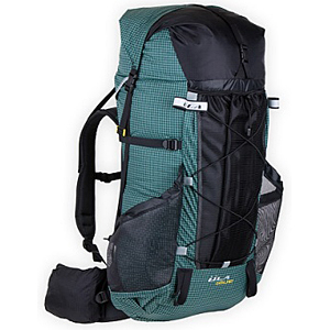
1. ULA Catalyst

This particular pack was a trail favorite for a lot of thru-hikers. At just over 2.5 pounds, it proved to be a great pack for ultra-lighters who could keep their pack weights below 40 pounds.

Another trail ULA favorite was the Circuit - the Catalyst's smaller, lighter brother, if you want to lighten your load even more.

2. Granite Gear Crown 60

Granite Gear has several different packs that thru-hikers oogled over, but the most popular by far was the Crown. With a large 60 liters of capacity and weighing in at 2.2 pounds, it proved to be a great fit for a lot of hikers. Plus, the roll-top ensured that the pack could expand and collapse as needed when you're carrying more or less than usual. The Crown's little brother, the Blaze, was also a popular favorite.

3.  Gossamer Gear Mariposa Ultralight

The lightest on the list at 1.6 pounds. Personally, I think once you start shaving too much weight from your pack, you lose comfort and durability, but some ultralighters can pull it off. This pack was usually seen on the hikers who were carrying a sub-10 pound base weight. Impressive.

4. REI Flash

I saw a lot of different iterations of this pack on trail. It comes in a men's 45 liter, men's 62 liter, and a women's 52 liter. I saw every size/color of the Flash throughout the trail, since there have been several updates over the years.

This is the pack I carried, and I loved it. It weighs just under 3 pounds for the 52 liter size and I found it to be really comfortable. I was jealous of those who could pull off the 45 liter size effectively. I had to wear the 52 to fit all my stuff, and even that was a challenge when I added a bear vault.


WATER FILTERS

1. Sawyer Squeeze

Hands down, this was the most prolific water filter on the trail. Gone are the days of pump-action water filters. They are slow, heavy, and way behind the times. These days, thru-hikers carry gravity, squeeze, or in-line filters for convenience, weight, and speed. Each type has its own pros and cons.

The squeeze is notable for its small size and ease of use. You simply screw the filter onto a water bottle filled with untreated water, then squeeze the water through the filter into another clean water bottle. Alternately, you can simply drink the unfiltered water directly through the attached filter.

At first this system seems like the perfect thru-hiking water filter. And in a lot of ways, it is, especially for overnight backpackers who don't have to worry about putting in a certain number of miles. They have the luxury of taking their time. But there are some notable cons with the Sawyer Squeeze that frustrated a lot of thru-hikers I know:

a) It takes time to filter your water. When you're in the desert, carrying up to 6 liters of water at a time, and you're planning on doing a lot of miles, filtering water is time consuming. You can sometimes spend up to an hour filling dirty water bottles and squeezing them into clean bottles through the filter. For a hiker who always wants to be moving, it can be frustrating to stop at each water source and take so much time filtering.

b) The squeeze bags the filter comes with break. Granted, this isn't too much of an issue because most people just use water bottles instead. But the squeeze bags are quicker and less prone to air pockets. Unfortunately, they also spring leaks quite often.

c) You have to keep track of your dirty/clean bottles. I can't tell you how many times I saw a hiker accidentally filter water into one of his dirty-water bottles, despite well labeled bottles. Making that mistake can quickly contaminate a lot of hard work. When you have half a dozen water bottles to contend with, it can be easy to mix them up.

In the end, most people who had Sawyer Squeeze filters ditched them for something simpler, like Aqua Mira drops. After a while they just weren't willing to take the time to sit at a water source and filter water for an hour.

2. Platypus Gravity Works

The Platypus Gravity Works has a few pluses that the Sawyer Squeeze doesn't: you don't have to sit and manually squeeze water through a filter for an hour. And you won't mix up your water bottles. It does the work for you, by simply filling up the labeled "dirty water bag" and letting gravity filter the water through the filter and into the clean water bag.

The con, unfortunately, is the time it takes. In the beginning all gravity filters are pretty speedy, but as you use them, they slow down, and even with a good cleaning and backflush, they're never quite as good as brand new. With two attached water bags (often ranging between 2 and 4 liters) they can also be bulky in your pack, depending on how much water you're carrying. In the end, this is a good system but your breaks at water sources will still be dictated by how fast your filter is filtering.

3. Sawyer 3-in-one inline filter

I find this filter to be the best of both worlds, and it was the one I carried throughout the trail with nothing but love for it the whole time.

This system essentially takes the water bladder and filter from the Platypus gravity system, but it eliminates the need for a clean water bag. Rather than waiting for your water to filter into another bag, you simply add the inline filter to the hose of your current water bladder. Then you fill up your water bladder with dirty water, put it back in your pack, and drink from the hose as you walk. Since the filter is integrated into the hose, it filters as you drink it, so you don't have to waste time filtering the water right when you find it.

The downside of the inline filter is that it slows the rate of water coming out of your tube. Some people find this frustrating, though I find that when I'm hiking I don't necessarily "chug" water. Instead, I sip at the hose in small doses, which is perfect for the flow rate. The only thing I didn't like was that I didn't have clean water at-the-ready when I wanted it. When I was taking breaks or eating lunch, I wanted a clean water bottle to chug, preferably with some flavored electrolytes in it.

So to compensate, here is the water system I came up with:

I carried a 3 liter Platypus water bladder tucked in the back sleeve of my pack. I drew a skull and crossbones on the bladder so I would remember that it had dirty water in it. I cut the hose on the bladder and clipped my Sawyer in-line filter into it. In this fashion I could drink dirty water directly from the bag while I was walking.

I also carried two 1 liter Gatorade bottles. One was labeled "dirty" and one was labeled "clean." (I also distinguished by keeping the label on the clean bottle and tearing it off the dirty one.) The dirty bottle I used for scooping water up from streams and rivers and used it to replenish the water in my bladder, since it was much easier to leave the bladder tucked into my pack rather than dragging it out every time I needed a refill. Generally, while I was walking my dirty Gatorade bottle was empty (unless I needed to carry an extra liter of water in dry areas.)

As for the clean Gatorade bottle, I only ever put clean, filtered water in it. To do this, I unclipped the mouth piece from my bladder hose and strung up the bladder from a tree or trekking pole and gravity filtered the water from the bag into my bottle. It was a slow process, but I only did this during breaks or lunch so I wasn't wasting time on trail. A lot of times I put the water bladder on my head and let it filter down toward my feet. This was sometimes easier than trying to find a branch to hang it from. This method tended to get a lot of laughs from fellow hikers.

Once I had a full liter, I could add drink mixes to it, and this became the water I drank when I stopped for a break. It was always wonderful chugging something with flavor after drinking straight water all day.

This system worked really well for me. I know there were some people on trail who disliked the in-line filter because it kinked up on them often and they couldn't get a good flow to come out while they were walking. This happened to me a number of times, too, but I could generally get it working again without too much effort. Overall, I loved the convenience and speed of simply filtering water on the go, and I was blessed to never get a water-borne illness because of it.

4. Aqua Mira drops

The final way people filtered water was through some sort of chemical. This is by far the lightest method you can use - Aqua Mira, iodine drops, and bleach in tiny bottles weigh hardly anything, and you only need a few drops per liter. There are a couple of downsides to chemicals, however:

a) You need to wait 30 min to 4 hours to kill everything. Generally you only need 30 minutes, but even that amount of time means you have to plan your water treatments carefully and make sure you won't desperately need some before time is up.

b) It's not advisable to use chemicals for more than two weeks at a time. Iodine and bleach do some seriously nasty things to your stomach. Most of the time it's too watered down to make much difference, but for those hikers who misjudged how many drops to put in their water paid the price with some stomach illnesses. I also knew a lot of hikers who got Giardia while trying to use bleach, whether from incorrect use or inconsistent use, I'm not sure. But if it were me, I wouldn't take chances.

I carried Aqua Mira drops as a backup. I never wanted to be stuck in the woods with a broken filter, so drops were there for me if I needed them. It turned out that I only used them once or twice my entire trip. Usually because I filtered water from a really gross cow-trough and, though I trusted my filter, I really wanted to kill everything in there. Otherwise, I carried them for peace of mind.


TENTS

1. Tarp Tent Contrail

For hikers who want the best of both worlds - the lightness of a tarp and the comfort of a tent - a tarp tent seems like the obvious solution. Tarp Tent makes a large variety of styles, but the Contrail was the one I saw most often. It was made for one person but is roomy enough for two - it seemed to hold up beautifully in the desert, but many people discovered its downfalls in the rainier states. It had a tendency to leak, and since the mesh lining was directly connected to the rainfly (ie, single wall) it managed to get everything wet inside, too.

2. Big Agnes Fly Creek 1 (and 2)

This was the most popular choice by thru-hikers. Most opted for the one person version to save weight, but when they realized the two person version is only 7 oz more and gives you twice the space, they gave themselves a "doh!" slap on the forehead. Weighing in at 2 pounds 10 oz (with stakes and footprint) it's a comfortable way to backpack across the US. Of course, it does have its shortcomings - a tiny vestibule, small zippers that are prone to breaking, and condensation issues, but even in the wettest conditions I was usually impressed by how well it withstood the elements.

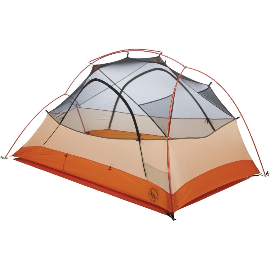
3. Big Agnes Copper Spur 2

For couples traveling together, the Copper Spur was an often-seen tent on trail. As a free standing tent, it's much roomier than the two person Fly Creek, giving each person a little more wiggle room and therefore (hopefully) keeping everyone happy.

4. Sil nylon tarp

For ultralighters, hardly anything outweighs a good ol' tarp. You can rig it up in any configuration you like with some stakes and two trekking poles, and the weight you save in your pack seems to make up for the lack of comfort in less ideal conditions, right? While this seems like the way to go in more arid environments (most people slept without tents in the desert, anyway) I wouldn't be caught with a tarp anywhere north of Crater Lake. But I don't like getting drenched with rain while I sleep. Maybe that's just me.

So those are the big gear choices everyone stresses over. The other big one would be sleeping bags, but that category ran all over the map and I hardly ever saw the same bag twice (although most everyone carried 20 degree down bags, from what I could tell) And for stoves and sleeping pads everyone carried the same things: for stoves it was the Jetboil Sol or an alcohol stove, and for the sleeping pad it was a Thermarest Z-lite in the desert and a Thermarest NeoAir everywhere else. (Although I did spot a few people with Exped pads.)

Hopefully that satisfied some gear junky cravings you've been having (admit it.) If you want to know more about what I carried on trail and how it worked for me, visit this page about my gear.

What Do You Eat on the PCT?

The main questions I received on trail were always about food.

Where do you get it? How much do you carry? What do you eat? were very common curiosities from dayhikers, locals, and fellow backpackers. They wanted to know if I hunted/foraged for food, or if I stopped in town. They wanted to know if I ate junk food, processed food, or fresh food. They wanted to know how often I resupplied and whether I mailed myself food or bought it in local stores. They wanted to know which foods I craved and which I didn't.

As you may have already read, I did a lot of pre-hike work on my food resupplies. I bought, prepared, boxed and labeled over 14 separate packages to mail to myself on trail. I created spreadsheets, organized itineraries, labeled shipping dates on calendars, and left Tanner behind with carefully bagged meals for every single resupply stop. I bought foods that I had eaten previously on backpacking trips, I went to WinCo and bought bulk foods: trail mixes, rice, pastas, banana chips, rice cakes, tuna packets, off-brand pop tarts, granola bars. I dehydrated vegetables and created pre-made meals for myself in ziplock bags. I was wonderfully prepared and I was convinced I would be set for the whole of the trail.

I was wrong.

Something happened that I would have never expected: I lost my appetite. For three whole weeks on trail, I could barely stand to look at my food, much less eat it. I carried it hundreds of miles through the desert, but when I stopped for snack breaks, I had to force myself to eat. The heat of the desert, the new experience of walking so many miles a day, the exhaustion and dehydration zapped me of any desire to eat. It made me nauseated. And so I carried pounds and pounds of food every day and barely ate any of it.

When at last - at last! - my appetite returned after three weeks on trail, I was ravenous. But I quickly discovered that I had a new problem: I didn't want anything I had packed for myself. My new backpacking body had specific needs, and like an overly pregnant woman, I had some very strange food cravings.

This was a surprise for me, because I assumed I would crave stuff like ice cream and candy bars, but I never did. In fact, I started to hate candy bars. I was the only hiker on trail who gave away all my Snickers bars. I started to crave stuff like fresh fruit, ice cubes, and gatorade. Flavored drink mixes helped, but they were never cold on trail.

I also started to crave things I never had much interest in before the trail, like hard candies, pancakes and chocolate milk. Something about the sugar and the carbs and the protein was just what my body wanted. In town, we would buy a whole gallon of chocolate milk for one day and drink the whole thing before leaving the next day.

I hated the trail mixes I packed in every box. I grew quickly tired of the rice meals I made. I choked on the off-brand pop tarts (cheaper isn't always better). I gave away all my snacks and off-brand granola bars and spent my time in grocery stores, trying to find foods that satisfied my food cravings. After a few weeks of playing with combinations, and through trial-and-error, I finally came up with my perfect resupply box.

I am one of those weird people who usually doesn’t tire of foods. I think I ate PB&J every day in school growing up. This was a blessing, because once I knew which foods I was craving, I could pack the same things in my resupply boxes and not get tired of them. Prior to my hike, I had packed boxes all the way from Mexico to Portland, assuming I would pack my Washington boxes when I got home again. This was a great idea, since I knew much better by then what I liked.

Here was a typical week's food resupply for me:

Breakfasts:

4 packages of Pop Tarts (generally raspberry or brown sugar) - for quick mornings
3 ziplock bags filled with granola and powdered milk - for slower mornings
3 Instant Carnation breakfast packets - vanilla or chocolate (to add to granola or oatmeal)

Lunches:

1 package of 10 large tortillas
7 foil packets of ready-made tuna salad
7 small bars of cheese (Tillamook has individually packaged cheddar slices)

Snacks:

1 small jar of peanut butter (the Planters chocolate and cherry one was a favorite)
1 package of turkey jerky
20-30 granola bars, assorted (depending on my mood)
1 package of dried fruit, nuts, or trail mix
5 packets of strawberries-and-cream instant oatmeal (I added water and ate this right out of the bag, usually for snacks rather than breakfast)
1 14oz bag of Skittles
Jelly bellies, jolly ranchers (great for the desert to keep your mouth from drying out), or other assorted hard candies
7  Little Debbies oatmeal cream pies (a personal favorite - I never eat them at home)
7 individual packets of Crystal Light flavored caffeinated drink mixes

Dinners:

7 Knorr Pasta sides, assorted flavors (I tried them all and grew tired of most of them, but the few flavors I could stand by the end were: broccoli and cheddar, spanish rice, and cheddar macaroni. By Washington I was mostly just making myself tuna wraps for dinner since I was too tired to cook.)

I made myself a tuna-cheese wrap every day for lunch and a pot of pasta every night for dinner. I snacked mostly on granola bars throughout the day, often covered in peanut butter for more protein. My "backup" foods were tortillas and peanut butter - if I was completely out of everything else, for some reason, I usually still had enough PB and tortillas to get me through to the next resupply stop.

I also loved picking up little treats for myself in towns. Different types of candies were always fun desserts, and special snacks for the middle of the day made me really happy when I opened my food bag and remembered they were there. My absolute favorite treat on trail was a bag of dried mangos - I had such a ridiculous craving for anything mango-flavored that I'm surprised it wasn't my trail name, since my hiking friends loved to tease me about it. (Treekiller even found me a mango-flavored beer in Bend!) I could never find dried mangos in town (it's sort of a specialty product) but my mom was awesome about sending me care packages. At every stop in town she would mail me a bag she had picked up from Costco. I'm sure it cost her just as much in postage as it did to buy the bag, but I loved it. The whole thing weighed at least two pounds, but I would happily carry it, trying to make the treat last me all the way to my next town stop.

For future thru-hikers who have questions about food preparation, I usually tell them the same thing: only send yourself boxes where it's absolutely necessary. There are a few stops on the PCT like that (Warner Springs, Seiad Valley, and Stehekin, to name a few) where there aren't any grocery store options, so it's better to mail yourself food. For everywhere else, you'll be better off buying food in town. Yes, it's a little more expensive that way (although factoring in shipping prices these days, maybe not...) but you're able to tailor your cravings directly to what you'll be eating on trail the next week, and having the right food is huge. A hungry hiker is an unhappy hiker. By the time you reach mid-California, you'll know exactly what you like and don't like, and a lot of hikers make themselves boxes along the trail and bounce them forward to more expensive towns ahead. Treekiller and Sunshine spent a whole day in Bend, OR making their boxes for Washington so they wouldn't have to worry about it later.

No matter how much you plan, your tastes and cravings change quite drastically when you're hiking 25 miles a day. You start to realize how wonderful fresh foods are, and you feel the effects of eating weeks and weeks of processed food, but ultimately you realize that processed foods are the quickest AND lightest way to get the required number of calories in you. (A lot of hikers drizzled olive oil on everything since that has the highest calorie per weight ratio) And in between, there are town stops where you have the luxury of eating whatever you want, whenever you want, to great excess. I like to say the PCT is a tour of food... you spend your days eating your way through the United States and, on occasion, walking it, too.

How Do You Navigate on the PCT?

A common question I get about the Pacific Crest Trail revolves around navigation. "How easy is it to find your way?" or "Is the trail well marked?" are often curiosities to people who haven't hiked the trail before. This post will help explain the nature of the PCT and how to find your way from Mexico to Canada.

First of all, the PCT is a very well-trod footpath. It has been a proposed trail since the 1930s, designated as a National Scenic Trail in 1968, and finally fully completed in 1993. Since then, hundreds of hikers every year set out to walk the entire 2,650 miles along a trail that is merely one foot wide.


MAPS

To find your way through three states and from one end of the country to another, hikers navigate in a few different ways. Most carry detailed, printed topographical maps that cover the entire trail in something like 500 pages worth of data. (You can see the maps yourself here). A hiker named Halfmile has very generously devoted his time and effort to make these maps available online for hikers for free. Not only do they show the PCT's route over contour lines and county lines, but they highlight campsites, water sources, show warnings and regulations, and give helpful tips for each section. For almost every thru-hiker on trail, these maps are a lifeline and a God-send. We divide up the pages by section and at each resupply stop we mail ourselves a new section of maps so we don't have to carry the entire 500 pages at one time. A lot of hikers re-use the maps by writing their journal entries on them.

Besides printed maps, hikers these days have become more and more reliant upon iPhone apps and guides to help them along their journey. The two most prevalent sources of electronic information this year on trail were Halfmile's App and Guthook's PCT Guide. (You can read more in detail about these programs on my "staying wired on trail" blog post here).

Both of these apps were helpful in their own way. Halfmile's App worked in conjunction with his printed maps; they showed waypoints, points of interest, campsites, and let you know exactly which mile marker you were at (and how many miles to the next waypoint). If you happened to stray off the trail, the app told you how far you were away from it and gave you a compass direction to find your way back.

Guthook's App had several helpful references that Halfmile did not: it utilized GPS tracking (which worked even without cell service) to pin-point your location on a map of the PCT. It gave you detailed information and photos of upcoming campsites, road crossings, water sources, and towns. It also gave you accurate elevation profile data, so you could see your overall gain/loss for the day and gauge your hiking speed accordingly. You could also see your approximate mileage based on nearby waypoints, but unlike Halfmile's App, it did not give an exact mileage number of your current location.

Both apps had their pros and cons, and by utilizing both on trail, the data was infinitely more useful. (For example, Guthook often had campsites listed that Halfmile did not, and Halfmile often had more detailed town information that Guthook did not). Overall I was very impressed by the ease of use and helpfulness of both these apps. On more than one occasion I found myself off trail, and with a quick look at Guthook's GPS, I could easily navigate my way correctly back.

On my hike, I relied most heavily on the PCT apps I had on my phone, and Katie relied on the printed maps. With both sets of information, we were able to get an overall view of what our hike looked like. You can get away with one or the other, but having both is invaluable.

I grew so attached to knowing my exact mileage and elevation for each day, that when I returned home and went on a long dayhike, I found myself reaching for my phone on more than one occasion to check my mileage. It was annoying realizing that I didn't have information close at hand anymore!


NOTES and MARKERS

If you set out to hike the PCT with a set of maps and good head on your shoulders, you will easily find your way to Canada (provided you can read the maps accurately, of course.) Although this is enough to guide you, once you're on trail you quickly discover that the PCT has some tricks up its sleeve. The footpath is simple enough to follow: generally its the only trail there is to follow, but just in case you're worried, every few miles or so you come across a PCT marker to reinforce that you are, in fact, on the correct trail.

But sometimes, especially in popular wilderness areas and national parks, you come across a multitude of trails all converging in the same place. There are signs everywhere, and more often than not, the PCT is not explicitly marked. The trail junction will say something ambivalent like, "to Spruce Glade Trail" or "to Bear Ridge," and unless you happen to know the surrounding system of trails really well (and you won't) you have no idea which path to choose.

Despite that the PCT signage people have some work to do in this area, most of the time you won't have to take out your maps to puzzle over which route to take. Why not? Because there have been hundreds of hikers who have had this same exact problem hundreds of times before you. And because hikers are naturally helpful, generous people, they will have left you a clue, just so you don't make the same mistakes they did.

These clues come in several different forms.

First:

Vandalization.
It's probably not kosher, but the simplest way to inform hikers where the PCT goes is for the first hiker to write on an existing sign in sharpie: "PCT North" with an arrow. And unless the sign has been swapped out recently by the forest service, these signs stick around for a long time, so years and years of hikers can all follow the same sharpie note that someone wrote back in 1998. And inevitably, a few minutes later you will see that distinctive PCT sign nailed to a tree or post, confirming your choice.

Second:

Notes on trail.
If there's not a good sign to write on, hikers resort to writing on little scraps of paper and leaving them behind with duct tape or under a rock. These sorts of notes are found all over the trail for various reasons: trail markers, wayfinding, pointing the way to water, warning hikers about wildlife in the area (bears, wasps, etc), and anything else you want to explain to those behind you. Some hikers even leave little notes of "hello! I miss you!" to hiking partners they haven't seen in a few days. These notes are extremely useful, joyful, and an efficient way to pass back information to a group of people who have no access to cell phone service or social media. In some ways, the PCT is its own pony express, creating communication in a place where otherwise there could be none.

Third:

Markers in the dirt.
If there's not a good sign to write on, or any paper to write with, the simplest way to tell a hiker where to go is to draw in the dirt. You can create all kinds of leave-no-trace artwork with sticks, rocks, pinecones, leaves, or lines in the sand. These creations are semi-permanent and easy to follow. We often come across mileage markers ("100 miles!" "2000 miles!") created on trail with bits of rocks or pinecones. But more importantly for navigation, we leave each other arrows, "this way!", or just two deeply dug tracks in the dirt that create a "highway" to walk along. If the trail split three ways, I learned to automatically look down at the dirt and search for the two parallel lines that someone created by dragging their trekking poles through the dust. These lines created a path that pointed the correct trail to follow.

In the beginning, I didn't always trust these lines or markers in the dirt. Who was to say that a thru-hiker made them? Or that they didn't lead somewhere incorrect? The markers were often vague or half-destroyed, and I usually double-checked my maps to verify the route. But in the end, the markers were always right. They were always right because hundreds of people followed those same markers every day, and if they were wrong, someone would have changed them already. Thru-hikers are very good about leaving notes for each other, as we've already discussed, and if someone had written an incorrect note, it would very shortly be changed/ added to/ corrected by someone else. By the end of my hike, I was 100% trusting every single marker I came across on trail without even a flicker of doubt, and they never steered me wrong.


FOOTPRINTS

And finally, the third way hikers navigate on the PCT is by footprints.
This is an acquired super-hero power that you gain after hundreds of miles of walking the same way. When you begin your journey, you walk for 700 miles through the most desolate desert terrain you have ever seen. In fact, it is so desolate that no one except thru-hikers ever seem to walk these trails. Thru-hikers, after all, are the only ones stupid enough to walk in the desert for two months.

But after days and weeks and months of walking the same pace, behind the same exact hikers every day, staring at the trail all day, one foot in front of the other, you start to notice things. Weird things. Like footprints. Sure, there are hundreds of them, daily tramping over each other, burying the old ones beneath the new prints, but somehow... they are familiar.

You start to notice the differences. You start to notice the patterns, and the lugs printed into the dirt, and the traction marks. You notice the backwards brand names, the size of the print, whether they pronate or supinate. At breaks you start to notice what shoes your fellow hikers are wearing. You find yourself glancing at their sole patterns when they sit down. You start noticing these patterns showing up in the dirt ahead of you while you're walking all day. You notice which shoe prints show up the most often. (Brooks Cascadias.)

And then, one day, the magic super-hero power strikes you. You can see them, the hikers, in the dirt. You know exactly who left each print. You know exactly when they came through, and who hiked through after them. You know exactly which direction they took, which path they chose, which water source they stopped at. And like a forest native, you begin to track them. You make choices based on their choices. Did they go to the left or right? Did they take a lunch break under this tree? Did they take the side trail to town or keep going?

Sometimes these choices influence your own. My hiking friends Wocka and Giddyup found their way to Kennedy Meadows one day because they followed Katie and my footsteps through the dirt. When our footprints suddenly ran out, they realized we had turned onto the paved road to the right of the trail and walked to town instead of continuing on the PCT.

When Katie and I walked through the Mojave Desert Aqueduct at night, we had a difficult time navigating the trail in the dark, since it was so flat and open. To keep ourselves on track, we shone our headlamps on the trail and followed Sansei's distinctive Chaco footprints all the way to our next water source.

When our friend Birddog took afternoon naps, he would wake up to find himself disoriented and often began hiking accidentally southbound, until he ran into another hiker. Finally Rotisserie gave him the tip: "when you wake up from your nap, Birddog, just check which direction the footprints are going!"

When Katie and I wore the same Brooks brand trail runners, I would hike behind her, intentionally placing my left footprints beside her right footprints as I walked. Hikers behind us would frequently joke, "it looked like you were hopping down the trail!"

We became stealthy, knowledgeable trackers and learned the footprints of our friends as well as we knew their habits and personalities.

And so, through map and GPS use, markers, notes, and footprints, these are the resources PCT hikers utilize to guide themselves - and each other - north from Mexico to Canada.